Skip to Content

Image for illustration only. It may show a product series rather than the exact product offered.

3D Aero Chart Phoenix Tucson Az

https://www-old.roctexo.com/web/image/product.template/101653/image_1920?unique=8ef9bbe
Part numbers : RX1-13-12430 , 13-12430
Unit of Measure: EA

81.76 EUR / EA 81.76 EUR 81.76 € excl. VAT

81.76 EUR / EA excl. VAT

Not Available For Sale

This combination does not exist.

Availability
Not in stock
Available to order. Lead times vary.

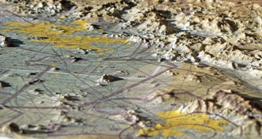
The 3-D Aeronautical Chart – Phoenix / Tucson is a moulded relief chart presenting the Arizona terrain from the Flagstaff and Mount Humphreys area south to Tucson. Its three-dimensional terrain representation is designed to help users visualise the relationship between terrain, airspace and flight planning information.

Suitable for flight-planning reference, training environments, offices, hangars and aviation displays.

  • Coverage: Phoenix–Tucson region, Arizona, including terrain from the Flagstaff/Mount Humphreys area to Tucson
  • Format: precisely moulded 3D terrain chart
  • Scale: 1:500,000
  • Approximate size: 76 cm high × 51 cm wide
  • Unit of measure: each

Roctexo part number: RX1-13-12430.

Orders with purchased items below 100.00 € incur a small order fee of 10.00 €. Both amounts exclude VAT. Shipping, other fees and core deposits do not count towards the limit.

These products might also be of interest

Your Dynamic Snippet will be displayed here... This message is displayed because you did not provided both a filter and a template to use.